After hiking in Great Britain’s little slice of real estate called Wales, it became all too apparent to me after trekking for just a short time that there is no such thing as a nice flat walk. The words from the Wizard of Oz came to mind as I braved sore leg muscles while huffing and puffing, “We’re not in Kansas anymore.” Yet what I found in experiencing history and breathtaking views made all the physical effort so worthwhile.
Hiking on the Lleyn Peninsula’s “cursed” and holy grounds
Stretching out like an elephant’s trunk from the rest of the Welsh mainland in the north is the Lleyn Peninsula, which contains some 95 miles of coastline to hike around. On a blustery, cloudy Saturday morning, we embarked on a challenging trek, which started just east of the old quarry village of Port y Nant in the midst of the Granite Valley on the western coast (roughly 45 minutes drive from Caernarfon). Stunning drops from cliffs lead to the Irish Sea as the path winded its way through hollows of coniferous forests and sheep grazing, until we arrived closer to the coast at Nant Gwrtheryn, where exhibits on the town’s quarry history and the Welsh language gave me more insight into the country’s legends.
Long ago, a village chief allegedly rejected three monks who came with their Christian message, resulting in some curses, including the inability for villagers to ever marry again, first coming to pass when the village’s eligible men were killed at sea. Then later (even after conversion), bridegroom-to-be Rhys and bride-to-be Meinir were playing a traditional hide and seek game on their wedding day, when the bride went missing for good. It drove the heartbroken groom to a slow insane death, and only later did a woodsman find the hidden bride after lightning struck a tree in half – as a skeleton wearing her wedding dress and sprouting golden hair from her skull.
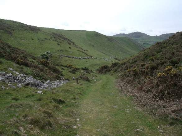
Our pathway continued further south along the rocky and jagged coastline, as non-stop splashes of the Irish Sea provided comfort for the ears as the sun’s rays gave warmth until we headed upwards on more grassy pathways, crossing over the same babbling brook a few times until we reached a hillpath. This joined the Old Pilgrim’s Way, part of a 47 mile coastal path dating from medieval times where Christians would trek down the peninsula all the way to Bardsey Island, nicknamed the “Island of 20,000 Saints.” Completing this journey three times was the equivalent to trekking to Rome, and could bring blessings.
As we meandered through grazing fields full of “baa-ing” sheep en route to one pilgrims’ respite spot, Pistyli Church (allowed to do so because of Britain’s “right of way” laws allowing access to fields as long as one stays on the pathways), I could empathize with the pilgrims of the past who struggled to get God’s best through arduous trekking. The church can still be visited, and contains many slate and sandstone gravestones with fading inscriptions.
Now, if you have the time and patience, you can walk the whole coastal pathway (including the eastern coastal trek upwards), seeing more pilgrim respite points, until you get to the old launching point to Bardsley Island at St. Mary’s Well at Uwchmynywd (now just a steep and dangerous drop). It was the last place where pilgrims could be blessed before braving the short but extremely dangerous journey to the island (due to the currents). Or you can take a long drive down the peninsula (like we did) and see for yourself what Christians past did to get God’s favor.
The Old Pilgrim’s Way shouldn’t be confused with the “New Pilgrim’s Way,” which features a much longer walk to Bardsey Island (110 miles).
Enduring challenging gusts of the Offa’s Dyke Path
The Offa’s Dyke Path runs some 177 miles north and south through the borderlands of Wales and England, hand dug 13 centuries ago on King Offa’s behalf. The 8th century Anglo-Saxon leader headed the kingdom at Mercia, and he wanted to use this earthen bank barrier to keep his Celtic enemies at bay. While pilgrims of this pathway may use some 12 days to fully complete the trail, I didn’t have that much time, but still wanted to experience some of the history of times past. My four mile-plus hike over a couple of hours started from a point about 25 minutes drive from Denbigh in County Denbighshire.
The afternoon skies all around the Moel (Welsh for ‘hill’) Famau County Park in the Clwydian Range were gray. The wind gust was steady as our goal was to proceed some 350 feet in elevation, first to the 2,500 year old Moel Arthur hillfort, where King Arthur purportedly based himself some 1.5 millennia ago and where gold prospectors once hunted treasure. Before we even began, a ewe sauntered own the road and began angrily baa-ing at us as to show her lambs who was in charge of the place since King Arthur was nowhere to be found.
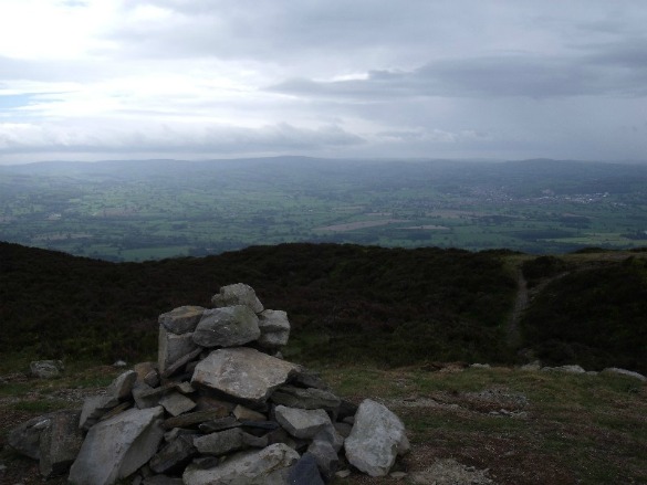
The dirt and rocky pathway upwards cut through the heather uplands sprinkled with bilberries as the gusts of wind strengthened. At the top, there’s little conspicuous proof that any structure was there, though sizable earthen ditches and banks surround the summit, now marked with a small pyramid-shaped rock structure. To the northwest, my eyes spotted a small forest, while to the east, England stood, the place that King Offa wanted outsiders to stay out of.
There was one more high point to conquer for me on this path a few kilometres away, which would involve trekking through that small forest en route to a higher plateau, another alleged Arthurian spot, the hillfort at Penycloddiau, the largest on the range built around the same time as Moel Arthur’s. This path was primarily made up of grass and dirt.
I descended and ascended extremely steep angles approximately 45 degrees for several hundred yards as the winds rustled through the pine trees, acting more ferocious, drowning out the sounds of skylarks and grouse. I could the feel the utter isolation in those stormy gusts beating at my face that those pioneers of centuries ago must’ve felt while trekking here. Upon arriving, the area had a similar appearance of Moel Arthur, but was larger, offering more grand views of the countryside in the midst of precipitation.
I realized that it’s not so much finding the remains of these places that provide a lifetime of memories, but the satisfaction in enduring challenging hikes in less than ideal weather via the footsteps of mythical figures.
“Slate” hiking in Padarn Country Park
I found out a lot about Welsh mining history hiking some of the northern part of Snowdonia National Park at Padarn Country Park. Not only does it contain an early 13th century Welsh castle called Dolbadarn Castle, but I got more insight into the importance of slate to Welsh history.
First, I decided to hike to this once stronghold for the Welsh Princes of Gwynedd, then the English after Edward I conquered North Wales. Two centuries ago, English artist JMW Turner captured the ruin’s beauty in a painting. Little is left of it except for its tower, though I did see where one of the fireplaces was carved into a wall. The Welsh didn’t have a lot of money to create massive castles like those found at Caernarfon or Conwy; and thus, Dolbadarn was quite small and more intimate than the projects of Edward I.
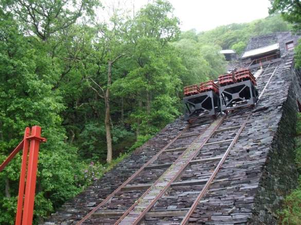
From the castle, short hikes through the oak-laden hollows off the shores of the lake lead to three free admission sites related to slate. At the old Vivian Quarry, I saw the remnants of mining activity as the steep and jagged slate now serves as a climbing and diving area, the latter because it’s full of water up to about 60 feet in depth, where automobiles and slate are submerged.
Further north, more winding hollows led me to the old Quarry Hospital, where I learned through exhibits in the operating theatre, three-bed ward, and the pharmacy of how the 3,000 miners paid some of their dues to get health care, often state-of-the-art for the mid-1800s through the mid-1900s (including an adjustable head set chair for eye exams). Patients had to provide one change of sheets per week and weren’t allowed to tip staff.
Off the main complex is a creepy mortuary, where two slabs of slate were the final resting spot for deceased bodies prior to burial. A short walk south to the shore led me to the National Slate Museum, full of all kinds of exhibits from mining equipment to photos which brought insight into the lives and work of the miners. I learned through a short film of how easily slate can be split by skilled workers.
More about Welsh Hikes
In order to participate in the walks I described, one should be physically active. Because of the steep gradients of many pathways, which are often slippery and full of sharp rocks, it’s also advisable to carry a quality walking pole that has a tip which won’t slip. Even though I normally run around six-plus miles per day while at home, my leg muscles were very sore from all the steep climbing and descending. But it was worth it!
It’s also imperative for independent trekkers to have Ordinance Survey maps of the areas they are hiking, as they provide valuable information about accessible pathways, proper place names, etc.
Additional Hiking Recommendation
The Isle of Angelsey contains a walking/hiking path called the Parys Mountain Copper Mines Industrial Heritage Trail (in the northeast). It features some less steep pathways to an abandoned copper mine dating from 1768, where my eyes caught the various colors of the landscape, like that of another planet. Classic episodes of “Doctor Who” were actually filmed here amidst yellowish gorse (which has a coconut scent) and heather.
Photo credits to Roy A. Barnes and may not be used without permission.
Roy A. Barnes attended a press trip sponsored by Visit Wales, but what he wrote are his own impressions without any vetting by the sponsor. The author writes from southeast Wyoming and is a frequent contributor to BootsNAll.com.


