Travel by day, step off the bus in interesting places, ask the ticket agent or driver which side of the bus will have the best views, and settle in for the exotic show. Some routes are more hair-raising than others, but except for a handful of countries, the roads are generally good, the routes are safe and the scenery is worth the longer hours of travel. Even if you experience some glitches along the way (which you inevitably will), it is all part of the South American adventure. Here are seven bus routes to consider for your trip.
Ciudad Bolivar to Santa Elena de Uairén, Venezuela
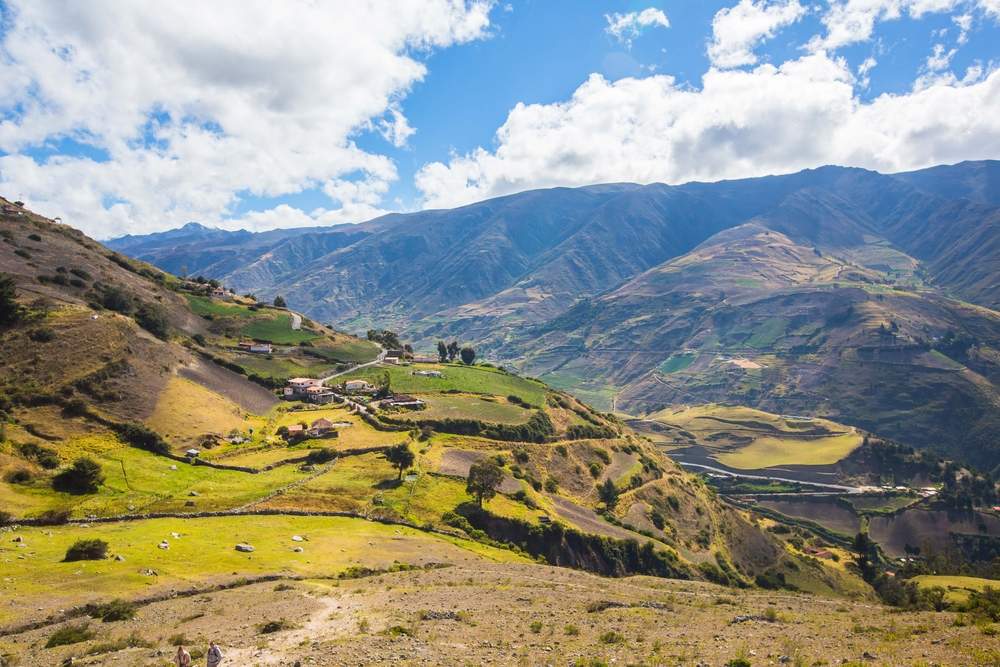
(293 miles/472 kms)
Start this incredible 11-hour journey through the stunning landscapes of The Lost World by either traveling by plane or bus from Venezuela’s capital city, Caracas, to Ciudad Bolivar, then connecting to Santa Elena, the main town of La Gran Sabana, a plateau that rises 3,280 ft/1,000 meters above sea level and is home to some of the most dramatic and beautiful scenery in the world. The route passes along the famed Orinoco River, the main “highway” for thousands of years for the native and later European populations, through green savannas, waterfalls, rolling hills, past towering tepuis, the incredible tabletop mountains of the area with their unique mountaintop ecosystems, until finally arriving in the historic town of Santa Elena de Uairén.
The town is located near the Brazilian border, at the southern tip of Parque Nacional Canaima, the location of Salto Angel (Angel Falls), the highest waterfalls in the world, and is also the jumping off point for excursions to Mount Roraima, the highest tepui of the area. The standard excursion is a six day trek up the side of one of the world’s largest tepuis, but shorter hikes at the base of the mountain are also available. Santa Elena itself is an interesting mix of cultures, as it is home to several indigenous groups who are diligent about passing on their language and cultures to new generations, and teaching their children native traditions, crafts and the languages of Spanish and Pemon. The town is also heavily influenced by Brazilian culture due to its proximity to the border, a short taxi or bus ride away.
Salta to Iruya, Argentina
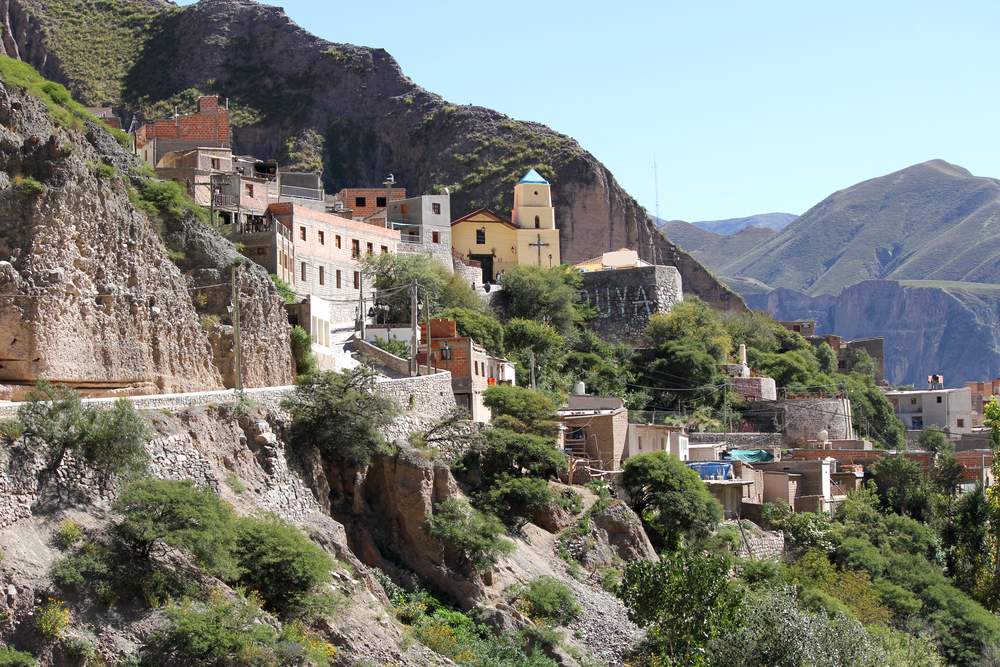
(191 miles/307 km)
There is beauty to be found even in starker landscapes, such as the northwest region of Argentina, famous for its history, Gaucho (Argentine cowboy) way of life, unique cuisine, spectacularly-colored geological formations, and vast cactus-filled deserts, canyons and dizzying heights. The bus route, often referred to as the Andean Circuit, can be completed in 12 hours or so, but is well worth breaking up the trip with stops in Salta, Tilcara and Quebrada de Humahuaca or Purmamarca.
Start by spending a few days in the cosmopolitan city of Salta, known to Argentines as Salta La Linda (Salta, the beautiful), visiting the museums, cathedral, leafy plazas, and excellent restaurants, and riding the cable car above the town for spectacular views of the landscape. Continue by bus to Tilcara to visit the pre-Incan ruins of Pucará de Tilcara, a former important center of culture and commerce belonging to the warrior Omaguaca tribe, dating back at least 10,000 years. Don’t miss the small, tranquil town of Quebrada de Humahuaca, whose backdrop is the multi-hued Cierro de Siete Colores (The Hill of Seven Colors) and is home to a daily native craft fair. The easily climbed hill across the road from the town’s center offers panoramic views of the colorful rose-lavender-orange-blue-green strata of the mountainside.
The next part of the bus route is not for the faint of heart, since it takes a decidedly hairy turn from Humahuaca to Iruya, as the road grows narrower and steeper as it climbs into the mountains, with little separating the unpaved road from the sheer drop below. Sitting 2,780 meters above the valley of the Iruyu River, the remote Shangri-la-like town of Iruya, originally a mountain transit town used a a stopping-over point on the trade route from the Puna Highlands to the Rio San Francisco, offers steep cobblestoned streets traversed by pack mules, excellent hikes and a glimpse into the slower-paced life of a remote mountain village.
>> Read about how to travel like a local in Buenos Aires or find more reasons to visit Argentina
Salvador de Bahia to Recife, Brazil
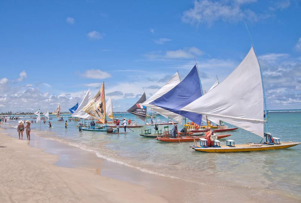
(569 miles/917 km)
One of the loveliest coastal bus routes in South America, this trip starts in the African-influenced UNESCO World Heritage Site of Salvador de Bahia and winds up the northeastern coast of Brazil to the bustling city of Recife. In general in Brazil, it is better to take a flight than a bus due to the sheer size of the country and the long distances between cities via the remote jungle terrain, often completely devoid of roads, but along the coast, the towns are more closely situated and the roads more manageable. Starting in Salvador de Bahia, take a few days to explore this fascinating city before setting out on the trip to Recife.
Salvador offers an authentic view into the strong cultural influence of Africa and the slave trade on Brazilian culture, from the excellent food to the retained customs and religion to the traditional music and dancing. Stop in any of the lovely coastal towns along the way for a chance to stretch your legs and to experience one of the most important aspects of Brazilian life: the beach. Maceió, the capital of the state of Alagoas, was originally the site of sugar mills, plantations and agricultural exports, but is now a tourist mecca known for its tropical climate, gorgeous white sand beaches, sailing, diving and lively nightlife and makes for an excellent beach stop.
The final destination, Recife, the largest city of the area with more than 4 million residents, is a center of industry, but is also developing its tourist side. The city is known as the Venice of the Northeast and is criss-crossed with waterways, islands and bridges and is situated in a zone of dense tropical rainforests. Another big draw to the area is the Porto de Galinhas, repeatedly voted the best beach in Brazil. Be sure to try the traditional African/Brazilian food along the way: Moqueca (seafood stew), Acarajé (shrimp fritters), Caruru (okra, onion, shrimp and toasted nuts) and of course, Caipirinhas, the national cocktail of Brazil made with cachaça, sugar and lime.
>> Learn about more places to go in Brazil besides Rio
Lima to Cuzco, Peru
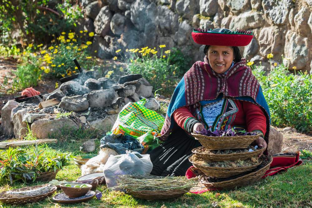
(703 miles/1131 kms)
Although a longer route than most of the recommended trips due to the varying terrain and the limited number of navigable roads, this is actually the most direct route by bus from Lima to Cuzco and also the most scenic. This route is more exciting than the longer route via Arequipa, often including vertiginous heights, narrow unpaved roads and sharp hair-raising turns, but the reward for ice water in the veins is a front row seat to the spectacular vistas of the land of the Incas.
Start by exploring the capital city of Lima, an urban and historical center of nine million inhabitants, before taking the bus to Nazca, the site of the famous Nazca Lines. Aside from creating the mysterious depictions of animals and humanoid figures in the desert that can only be seen fully from the air, the people of the Nazca civilization that flourished from 300 BC to AD 800 also created a complex system of still-functioning aqueducts.
Situated at a height of 11,200 ft/3,400 mts, Cuzco was the center of the Inca Empire and is now a designated UNESCO World Heritage Site. Although the city receives over 1.5 million visitors each year, it has managed to retain its sense of charm and history, albeit geared to the tourist trade. Be sure to visit the Plaza de Armas, especially at night when it is lit up and full of life. The Coricancha temple, one of the most important in Peru, and Sacsayhuamán, an impressive walled complex which houses structurally sound buildings of polished stones cut to exact precision and constructed without the use of mortar, are the area’s other main attractions. One word of warning for this bus route: the altitudes can be overwhelming for those used to living at sea level, so altitude sickness is a real threat. Avoid or mitigate symptoms by staying hydrated, taking altitude sickness pills and not over-exerting yourself until your body adjusts to the lower oxygen levels, which normally takes 2-3 days.
>> Learn about unexpected treasures of South America
Valparaiso to Puerto Varas, Chile
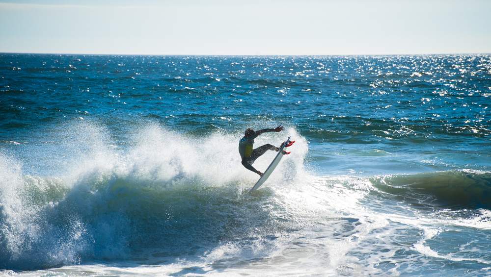
(618 miles/996 kms)
It’s hard to say which of South America’s countries is the most beautiful, but Chile is a top contender. One of the most economically successful of nations, Chile is also one of the safest, and has one of the best infrastructures, making it a relatively easy place for tourists to travel. The only real hindrance to road travel in Chile – the dramatic landscape (heavily mountainous to the east, vast deserts in the north and an extensive network of fjords in the south) – is less of a problem in this part of the country.
Start with a few days in Valparaiso, the UNESCO World Heritage Site, exploring the colorful cityscapes and the system of funiculars, one of the most unusual in the world. Next, stop at Santiago, a cosmopolitan, modern city of 7.2 million inhabitants with a lively restaurant and cultural scene, extensive parks and an excellent transportation system. Get back on the bus to head south to Temuco in Patagonian Chile, a hub for tourist excursions due to its proximity to numerous lakes, the Andes Mountains, parks such as the huge 150,000-acre Conguillio National Park and to the Llaima Volcano, one of the largest and most active in Chile.
Arrive in Puerto Montt, the center of the farmed seafood industry in Chile, and take a local bus or minibus (collectivo) to Puerto Varas, a lovely, peaceful, lakeside community deep in the heart of the Lake District of Patagonia and one of the most picturesque towns in South America. Puerto Varas’s backdrop is the Osorno Volcano, an almost perfectly conical, snow-capped active volcano. The town, also known as The City of Roses, is an excellent base for exploring the area’s parks and lakes, including Llanquihue Lake, one of the largest natural lakes in South America, and the extensive, well-staffed and well-maintained Parque Nacional Vicente Pérez Rosales.
>> Learn about wine tasting in South America
Bogotá to Cartegena, Colombia
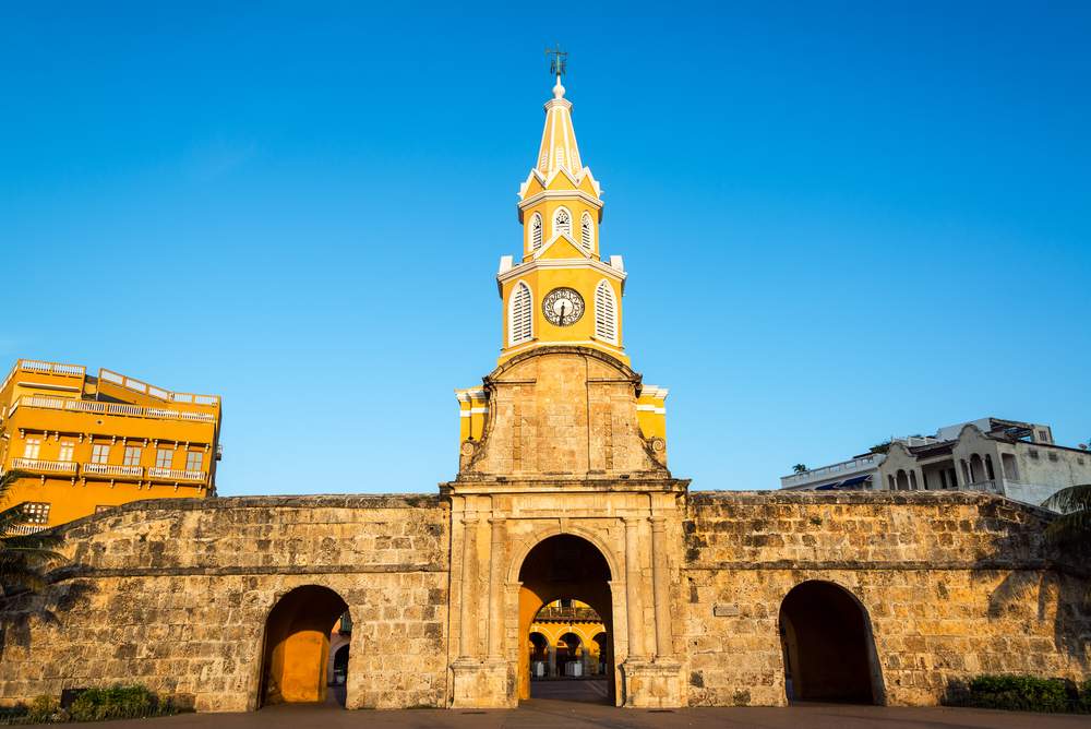
(605 miles/973 kms)
Although many tourists still have trepidation about traveling through Colombia, the country is much safer than it has ever been and is much more geared toward tourism. Locals and travelers use the cross-country bus system with few problems and it is well worth it to stop at the interesting towns along the way. Start in Bogotá, Colombia’s capital city, and one of the highest at 8,612 ft/2,625 meters above sea level. Take the cable car or funicular to the top of Cerro de Monserrate for fantastic views of the city and surrounding area.
From Bogotá, travel to Medellin. Traditionally a center of literature and art in Colombia, the city is redefining itself as a modern, progressive city with much-improved security. Medellin is still famous for its outdoor art and sculpture, so just wandering around will provide a cultural experience. Birdwatchers will want to visit the nearby Río Claro Valley with its naturally formed marble formations and clear river.
Next, head to Bucaramanga, also known as The City of Parks, one of the most beautiful cities in South America, with over 160 parks to explore. Visit the gorgeous Catedral de la Sagrado Corazon, the 18.5 acre Jardín Botánico Eloy Valenzuela with its Japanese Tea Garden, and partake in the area’s most popular activity, paragliding. Finally, arrive at the colonial beach resort city of Cartagena, where the history and culture dates back at least to 4,000 BC. This jewel of a city has been the backdrop for many Hollywood and South American films and TV shows including Love in the Time of Cholera, The Mission, and Miami Vice (Romancing the Stone was actually filmed in Mexico). Be sure to visit the old walled town, Centro Amurallado, for a glimpse into the colonial history of the city; the Castillo de San Felipe de Barajas, the huge fortress overlooking the city; and the Playa Blanca (White Beach), one of the best in Colombia.
>> Read why you should go to Colombia
Pucon, Chile to San Carlos de Bariloche, Argentina
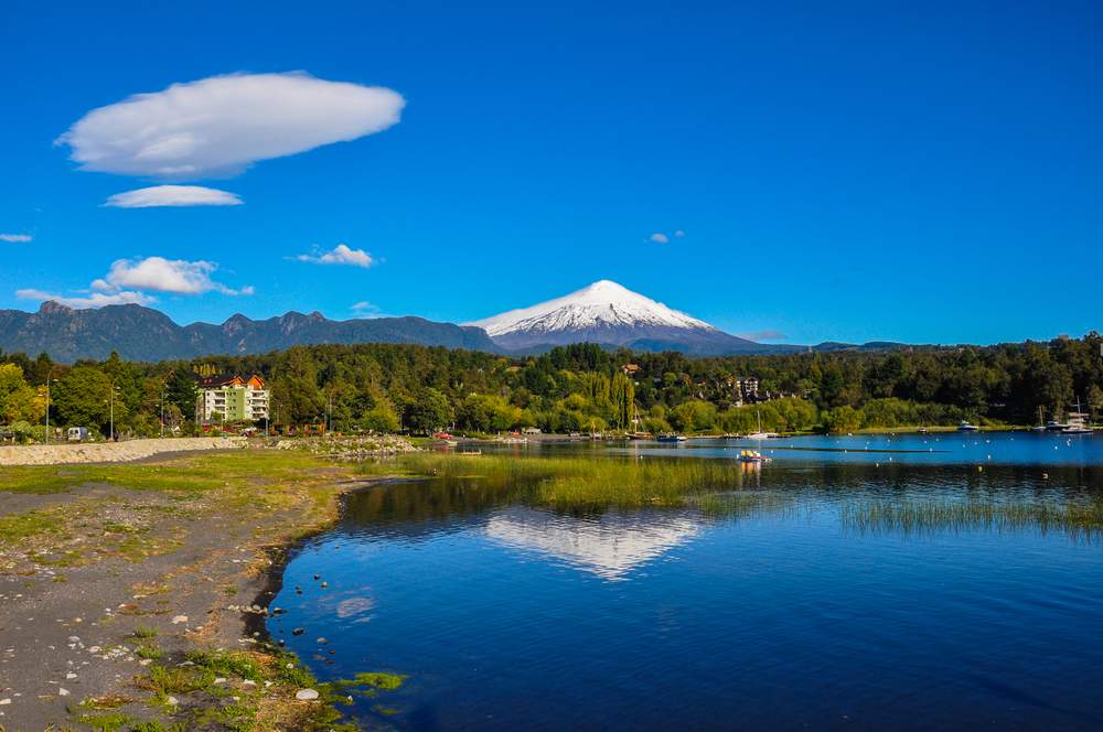
(265 miles/426 kms)
One of the loveliest routes crossing the border between Patagonian Argentina and Chile is from Pucon, Chile to San Carlos de Bariloche via San Martin de Los Andes and the Siete Lagos (Seven Lakes) Region. Pucon sits on the edge of the 30,888-acre Parque Nacional Huerquehue and is a great base from which to sample the area’s numerous outdoor sports options: hiking, volcano climbing, whitewater rafting, mountain biking, zip-lining, skiing and horse-trekking. From Pucon, take the bus through the mountains and across the border to Argentina, through the Seven Lakes region, past smoking volcanoes, azure lakes, lush green forests and rugged snow-capped mountains.
Take a break in San Martin de Los Andes, an upscale and popular Swiss-themed ski resort town situated at the foot of the Andes on the shores of Lácar Lake. If time permits, reserve a spot on one of the daily tour boats that cruise the Seven Lakes or rent bikes and explore the area on your own. Be sure to sample the Swiss hot chocolate and European pastries that the area is famous for, then continue on to San Carlos de Bariloche, known simply as Bariloche to locals, for unparalleled trekking. Scale the 12,388 foot Volcán Lanín located in the heart of the Parque Nacional Lanín, or, if you prefer history, tour the Cavernas del Viejo Volcán (Caverns of the Old Volcano) to combine amazing views with a glimpse into the ancient Mapuche tribe culture.
Read more about South America:
Photos: Jess Kraft , Hugo Brizard , Jess Kraft , Pablo Rogat , ostill , Vitoriano Junior , Spectral-Design Aleh Mikalaichyk